Surfing the Tide of Change: How an Australian Oceanographer is Making Waves in Environmental Science

Driven by a desire to participate in pioneering research, Australian oceanographer and avid surfer Serena Lee journeyed halfway across the globe to California’s Central Coast, forging new connections at Cal Poly’s College of Engineering.
In accepting a research fellow position, her goal was to further investigate the effects of sea-level rise on coastal towns, while actively involving students and the public in efforts to address climate change.
She began collaborating with civil engineering Professor Stefan Talke upon her arrival at Cal Poly in fall 2022, studying tidal ranges, trends and their impacts to understand the influence of tidal variations on coastal ecosystems and communities.
She also started a partnership with the Coastal Commission to boost public participation in the California King Tides Project. The project invites people to document exceptionally high tide events, known as king tides, by capturing and sharing photos of the coastline.
King tides, which offer a glimpse into future sea-level rise scenarios, serve as a powerful visual tool for understanding the impacts of climate change. The next king tide is expected on Feb. 9.
“We are breaking barriers between the public and science as we all try our best to solve this issue,” said Lee, whose unmistakable passion for the ocean is complemented by an infectious excitement about helping protect the marine environment she loves. “This is leading to more conversations and collaborations, which are key in our fight to combat climate change.”
From the Gold Coast to the Central Coast
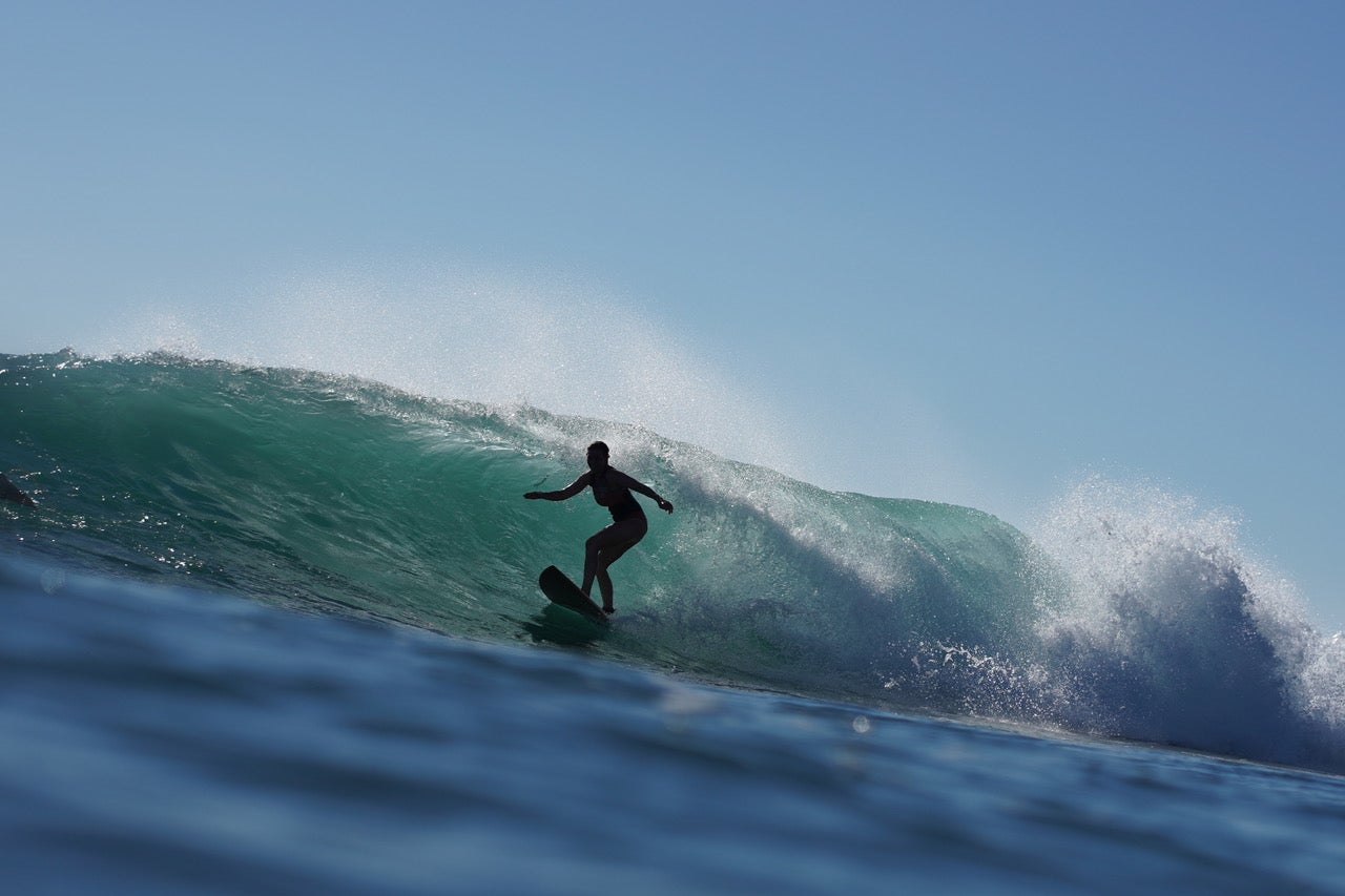
Born in Noosa, Australia, and growing up near Sydney’s eastern beaches, Lee learned to surf under her father’s guidance. She describes the pristine and crystal-clear waters that felt like coming home.
After completing her studies in physics and pure mathematics at Sydney University in the mid-’90s, she pivoted to environmental science. However, she quickly discovered the field in Australia was predominantly centered around biological and ecological research, leaving few career opportunities for individuals with a strong background in mathematics and physics.
She found success in the hospitality industry, but her passion for the ocean persisted.
“I was managing cafes around age 30 and found myself asking the question: ‘Is this what I wanted my life to be?’” she recalled. “I realized I had to change course to truly feel like I was making a positive impact.”
She returned to Sydney University to pursue a master’s in coastal science, quickly earning a scholarship for a doctorate in geoscience due to her math and physics expertise. By 2006, her skills were highly sought after in environmental science, thanks to the rise of numerical modeling. After her doctorate, she conducted postdoctoral research at the University of Maryland, followed by a vice chancellor’s research fellowship back in Australia, on the Gold Coast, renowned for its surfing.
Her decision to move to California was prompted by that job listing advertising a research fellow position to aid Talke in his work.
"I recognized Professor Talke’s name from his research papers,” she explained, “and being in the United States makes collaboration much, much easier since you don’t have that 15-hour time difference,” she said.
Lee admits she experienced a bit of culture shock when surfing on the Central Coast as opposed to Australia, having to switch from her usual no-wetsuit routine to facing the chilly waters that necessitate full gear. Still, a surfboard is perched in her Cal Poly office, ready for the next wave.
Reading tide gauges and documenting king tides
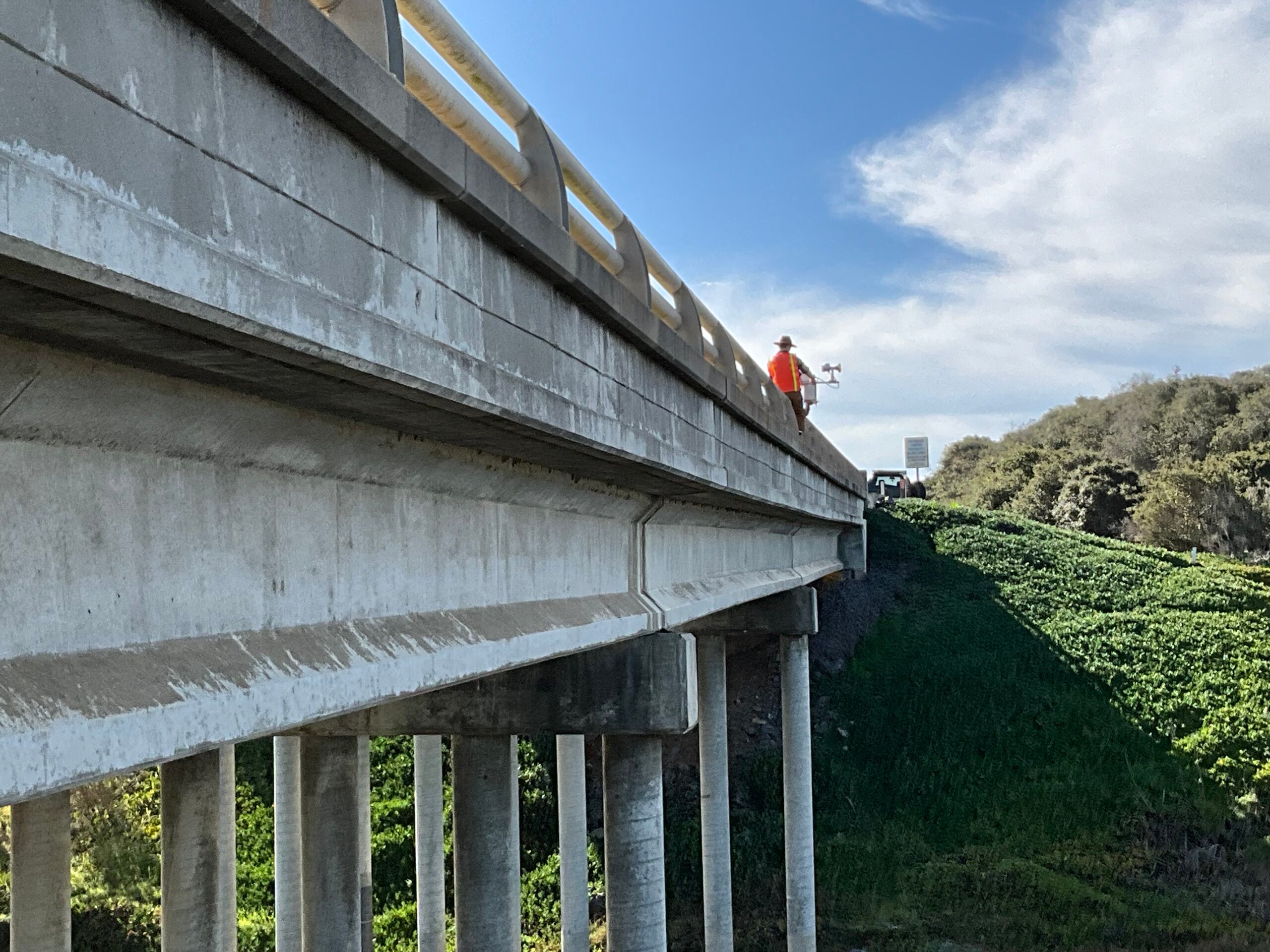
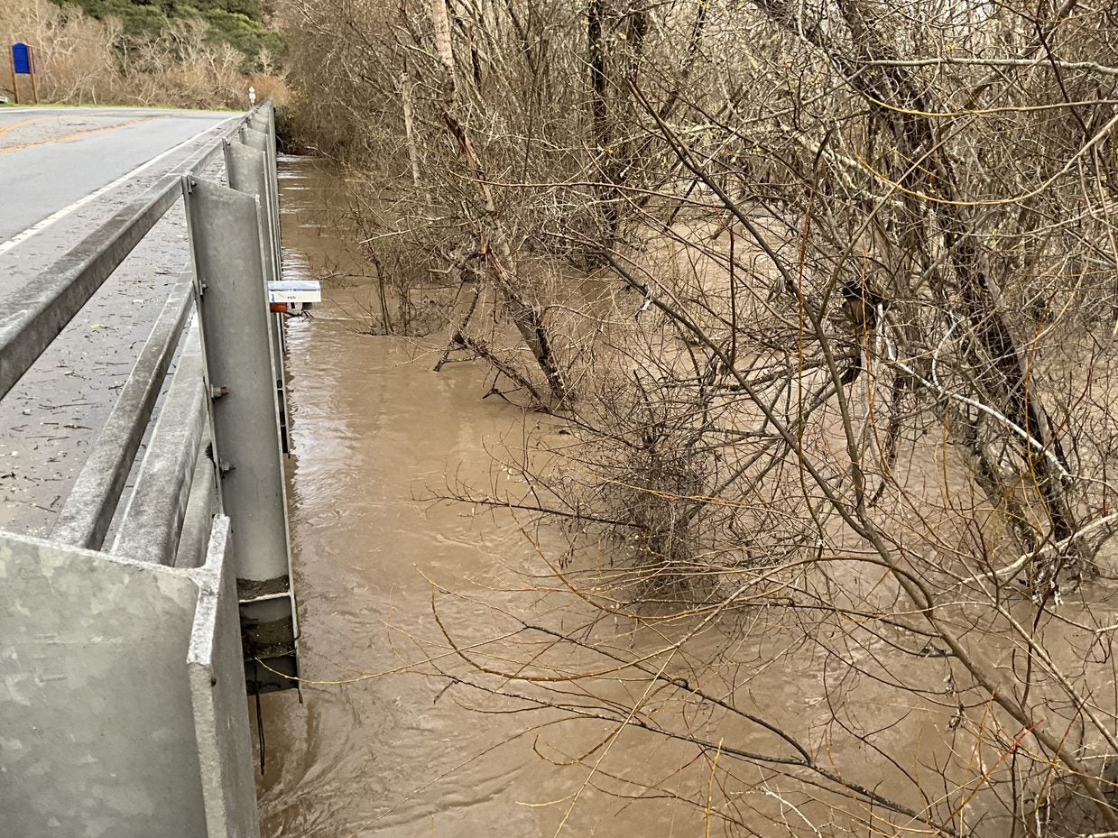
Recently, Lee took a group of students to the Cayucos Pier and the Coast Guard Jetty in Morro Bay, where she showed them how to collect data from tide gauges that are critical for monitoring sea-level changes and assessing coastal flood risks.
“We can learn about sea-level rise from tide gauges, especially from the ones that have been there a really long time,” Lee said. “That’s when you start to see incremental increases.”
The National Oceanic and Atmospheric Administration (NOAA) manages a network of 43 tide gauges along California’s coastline, with each unit priced between $20,000 and $30,000. Most devices are clustered around San Francisco and Los Angeles, leaving less than 10 for the rest of the coastline.
Under Talke’s direction, students engineered a model for only $300 and have since installed the sensors at piers and jetties along the San Luis Obispo County coastline.
The sensors measure both tides and waves and show promising capabilities, according to Lee, who is teaching students how to collect data from the instruments.
“Every time we are out with student collecting data, people will stop us and ask what we are doing.” Lee said. “We share about how the students built the gauges that will be used to show trends and the impact on coastal infrastructure.”
She noted the interactions offer a prime opportunity to initiate discussions about the tangible effects of climate change, highlighting its real-world impact.
Lee is also leveraging that curiosity through the California King Tides Project.
After the tide gauges were installed at Cal Poly, she reached out to the Coastal Commission, and the King Tides Project organizers responded with an invitation for Cal Poly to host an official event, such as a shoreline walk, during a future king tide.
King tides occur when the Earth, moon and sun are aligned, causing the gravitational pull on the Earth’s oceans to increase, and resulting in exceptionally high tides.
Lee plans to continue documenting the shoreline during such events, creating a record of changes affecting the coast and estuaries. She is also encouraging others to participate, fostering a collective effort to monitor and respond to environmental shifts.
“Even images of water on the coastline can provide us with so much information,” she said. “And it can provide information to people who may not think about climate change. It’s an easy entry point to the issue.”
Learn more about the California King Tides project and how you can document the next king tide on Feb. 9 here.


